GPS Maps, Navigation & Traffic
Screenshots


What is GPS Maps, Navigation & Traffic
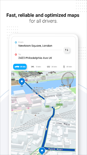
Get moving with GPS Maps, Navigation & Traffic, a fast, feature-packed navigation app built for US drivers and commuters. High-energy routing, live traffic, and offline maps combine into an action-ready tool - download now and take control of the road.
📌 Core Features
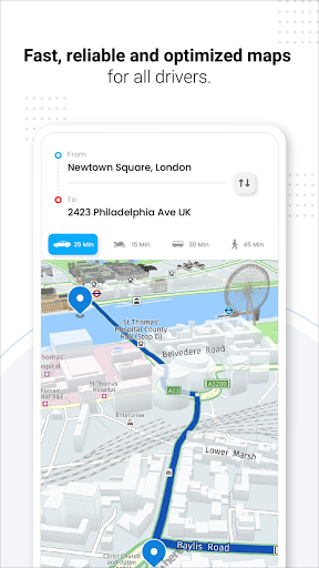
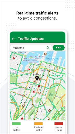
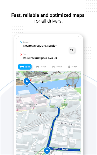
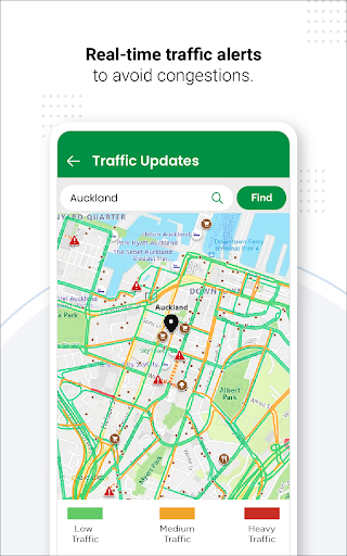
Real-time traffic updates: Live traffic data reroutes around congestion, accidents, and road closures to minimize delays. Traffic-aware ETAs adjust dynamically across US routes for reliable arrival times. 🚦
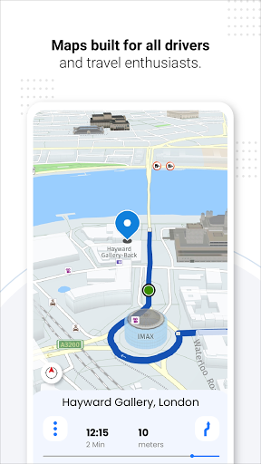
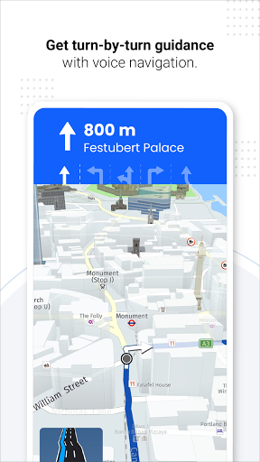
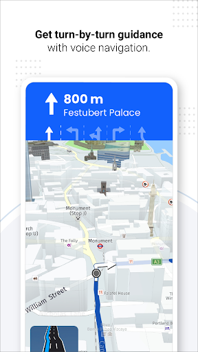
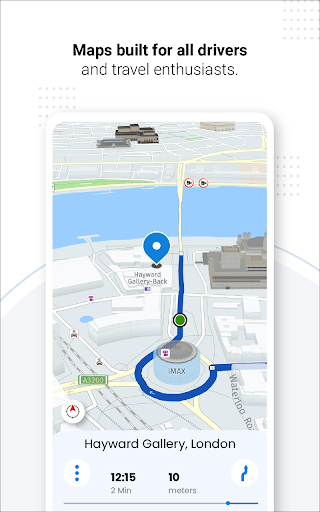
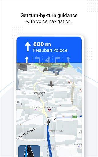
Turn-by-turn voice navigation: Clear voice prompts guide every turn with lane guidance and spoken street names for safer driving. Language options and volume controls fit different driving environments. 🎙️
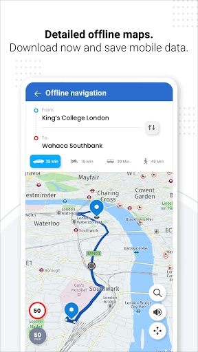
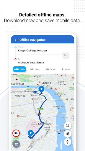
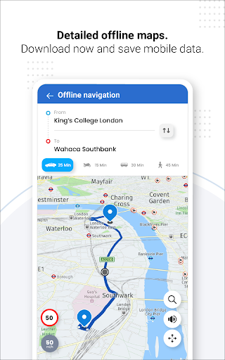
Offline maps and downloads: Download regional maps for offline use to stay navigable without a cellular connection. Offline routing and search keep trips moving in low-signal areas. 🗺️
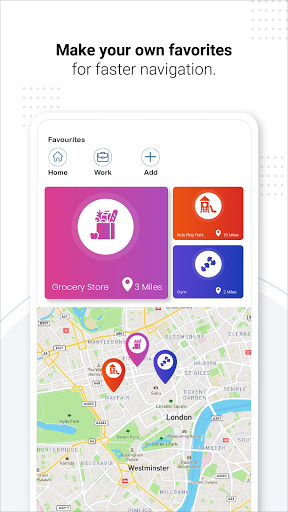
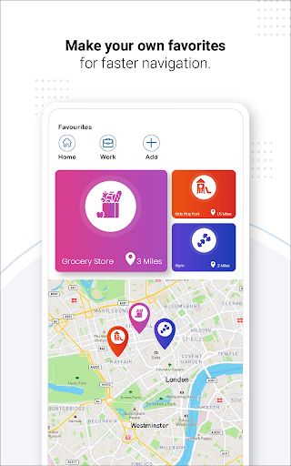
Multi-stop route planning: Create and optimize routes with multiple stops for deliveries, road trips, or errands. Reordering stops recalculates total travel time instantly. 🧭
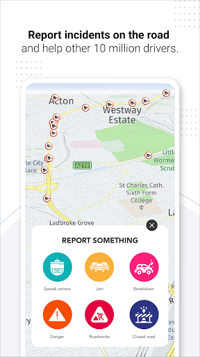
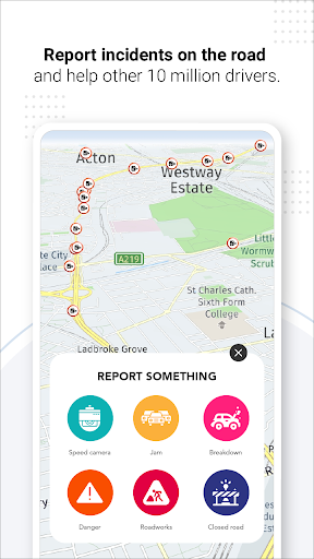
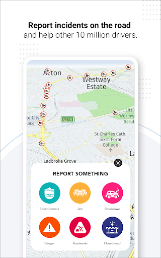
Speed camera and hazard alerts: Automatic alerts notify of speed cameras, school zones, and roadside hazards to reduce ticket risk. Customizable alert sensitivity matches driving preferences. ⏱️
👍🏼 Pros
Accurate ETA predictions: Smart routing blends live traffic and historical patterns to deliver dependable arrival times. Real-world timing helps time-sensitive commutes and pickups. ✅
Clean, responsive interface: Intuitive maps and quick-access controls reduce distraction while driving. Fast map rendering keeps navigation smooth on a range of devices. ⭐
Robust offline capability: Offline mode preserves core navigation and search when cellular data is unavailable. Ideal for rural routes and international travel with pre-downloaded maps. 🔒
Hands-free voice control: Voice commands enable safer route changes and search while keeping hands on the wheel. Supports common voice phrases and quick corrections. ⚡
Affordable premium tier: Paid plans add advanced features like ad-free maps and enhanced traffic layers at competitive prices. Flexible billing options let drivers choose monthly or yearly plans. 📶
👎🏼 Cons
Privacy and data collection: Precise location, driving patterns, and device identifiers are collected for routing and analytics, which may concern privacy-focused users. Review permissions and privacy settings before enabling full features. ⚠️
Battery and data use: Continuous GPS and live traffic updates can increase battery drain and cellular data usage on long trips. Background location access may further impact device runtime. 🔋
Ads on the free tier: The free version displays ads that can interrupt the map view and search experience. Ad removal requires a paid subscription. 📢
Occasional map inaccuracies: Rural roads and newly constructed streets may show delays in map updates, causing occasional detours. Cross-check unfamiliar routes when possible. 🧭
Subscription needed for advanced features: Advanced traffic layers, speed camera alerts, and offline packs may be locked behind a subscription or one-time purchase. Frequent drivers may find costs add up over time. 💸
💰 Prices
Free download with basic navigation and ads included for casual use. Premium subscription removes ads and unlocks offline maps, advanced traffic layers, and speed camera alerts for about $4.99/month or $29.99/year, often with a 7-day free trial. One-time regional offline map packs typically cost around $19.99 per region.